BG Cartography

  • blog
  • work
  • contact

logo

Building a logo with arcmap
Posted by Brian in ArcMap, Design, GIS, Symbology
Building a logo with arcmap

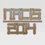
Here’s how I built a logo for my presentation at NACIS last year using only arcmap! I wanted to demonstrate that design can be done in ArcMap, this was my inspiration to design an arbitrary logo, my cheapo nylon yamaha, which I love the rosette on: Here’s a video of the process: And here’s a […]

share

  • Click to email this to a friend (Opens in new window)
  • Click to print (Opens in new window)
  • Click to share on Facebook (Opens in new window)
  • Click to share on Twitter (Opens in new window)

Read More

TV typography in ArcMap – Modern Family
Posted by Brian in ArcMap, Design, Labeling
TV typography in ArcMap – Modern Family

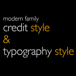
Here’s how to create typography similar to modern family’s title scenes. Here’s what the typography in the title scenes for modern family looks like. Here’s what you can do in ArcMap. Formatting tags! If you want to try this yourself, make sure you have gill sans light or you can go over to www.dafont.com and download faber […]

share

  • Click to email this to a friend (Opens in new window)
  • Click to print (Opens in new window)
  • Click to share on Facebook (Opens in new window)
  • Click to share on Twitter (Opens in new window)

Read More

TV typography in ArcMap – The Walking Dead
Posted by Brian in ArcMap, Design, Labeling
TV typography in ArcMap – The Walking Dead

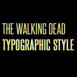
Here I’ll show you how to create typography similar to walking dead’s title scenes. Here’s what the typography in the title scenes for walking dead looks like. Here’s what you can do in ArcMap. This is possible with the use of formatting tags. If you want to try this yourself, go over to www.dafont.com and […]

share

  • Click to email this to a friend (Opens in new window)
  • Click to print (Opens in new window)
  • Click to share on Facebook (Opens in new window)
  • Click to share on Twitter (Opens in new window)

Read More

Search

Recent

  • LocationCon 2017

    May 24, 2017
  • Quick and Easy Custom Google Earth Legends

    Quick and Easy Custom Google Earth Legends

    February 1, 2017
  • NACIS 2016

    NACIS 2016

    November 1, 2016
  • Write ArcMap Layers to Text File with Python

    July 8, 2016
  • Python to batch generate QR codes

    Python to batch generate QR codes

    March 25, 2016

Categories

  • ArcMap
  • Data
  • Design
  • GIS
  • Illustrator
  • InDesign
  • Labeling
  • Mapbook
  • Symbology

Tags

Adobe ArcMap arcpy automation Cartography data data driven pages Design GIS google google earth Illustrator InDesign index kml kmz label Labeling labels logo Map maplex mapping maps metadata mxd processing productivity python QGIS script scripting SQL symbol Symbology typography zip

© 2025 BG Cartography All Rights Reserved.

loading Cancel
Post was not sent - check your email addresses!
Email check failed, please try again
Sorry, your blog cannot share posts by email.