Extract Excel attributes to CSV

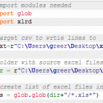
This is a python solution to pull specific cells from a bunch of excel files into one CSV file. The source excel files have a consistent format – that is, a given cell in every excel file contains the same information. I wrote this script because I needed one compiled table with spatial information for geocoding […]
TV typography in ArcMap – Modern Family

Here’s how to create typography similar to modern family’s title scenes. Here’s what the typography in the title scenes for modern family looks like. Here’s what you can do in ArcMap. Formatting tags! If you want to try this yourself, make sure you have gill sans light or you can go over to www.dafont.com and download faber […]
TV typography in ArcMap – The Walking Dead

Here I’ll show you how to create typography similar to walking dead’s title scenes. Here’s what the typography in the title scenes for walking dead looks like. Here’s what you can do in ArcMap. This is possible with the use of formatting tags. If you want to try this yourself, go over to www.dafont.com and […]
Hyperlinks to local docs – ArcMap and Google Earth

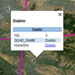
As you should know google earth pro is now free. Yesterday, I set up a kml with hyperlinks to local pdf’s via a relative link. I can’t show what I was working on but I’ve recreated it with some public data. In arcmap, I have 4 USGS quad boundaries. I also have the corresponding quad […]
Symbol on line in arcmap

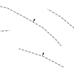
Yesterday, I needed to add an arrow onto the middle of a line, perpendicular to that line. In ArcMap, this can’t be done with line decorations but it can be done via the line labels. I can’t really show what I was working on but the idea is shown below. To set this up, turn […]
