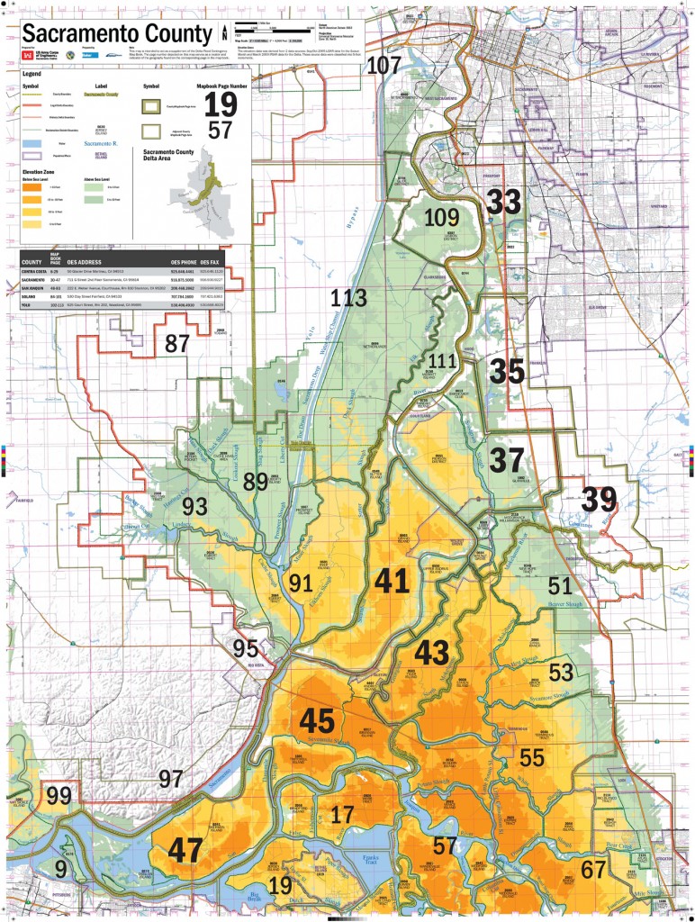
 A series of 5 maps over the 5 delta counties. The wall maps serve to connect the county Emergency Operations Center to flood fighters on the ground using the Delta Mapbook. The wall maps function as a locator map for each page of the Delta Mapbook and provide some base map data as well.
Leave a Reply
Print, 44x34", 5 maps
