LocationCon 2017
Download my slides from LocationCon in Oakland, CA 5/24/2017 at the link below. Workflow and Design of an Emergency Flood Response Mapbook [360MB] More content to come…
Python to batch generate QR codes

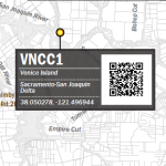
This is an overview of a script I developed utilizing python urllib, google’s chart api, and NOAA’s live stream monitoring charts. I created this proof of concept for a paper map that includes some graphic labels for stream monitoring stations, including a QR code that can be scanned to bring up the live chart for the stream […]
Point with label & auxiliary label in ArcMap

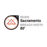
This is a walk-through on how to create an auto label like below in ArcMap. I’m using maplex on ArcGIS 10.3. A layer package corresponding to this can be downloaded here. I’m working with some fake levee breach data here with the goal to fit the breach number label onto a specific part of the custom […]
TV typography in ArcMap – Modern Family

Here’s how to create typography similar to modern family’s title scenes. Here’s what the typography in the title scenes for modern family looks like. Here’s what you can do in ArcMap. Formatting tags! If you want to try this yourself, make sure you have gill sans light or you can go over to www.dafont.com and download faber […]
TV typography in ArcMap – The Walking Dead

Here I’ll show you how to create typography similar to walking dead’s title scenes. Here’s what the typography in the title scenes for walking dead looks like. Here’s what you can do in ArcMap. This is possible with the use of formatting tags. If you want to try this yourself, go over to www.dafont.com and […]


